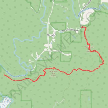
Hike of Browning Hill Trail via Wilkerson Hill and Nebo Ridge Trail
- Distance: 14.4 Km
- Elevation gain: 322 m
- Maximum elevation: 279 m
- Elevation loss: 337 m
- Minimum elevation: 169 m
Interactive trail map
Trail profile
- Distance: 14.4 Km
- Elevation gain: 322 m
- Maximum elevation: 279 m
- Elevation loss: 337 m
- Minimum elevation: 169 m
About this trail
Name: Hike of Browning Hill Trail via Wilkerson Hill and Nebo Ridge Trail trail, distance, elevation, map, profile, GPS track
Start: West Elkinsville Road, Elkinsville, Brown County, Indiana, 47448, United States (39.07871 -86.24923)
End: 158, West Elkinsville Road, Brown County, Indiana, 47448, United States (39.07919 -86.24867)
Coordinates: 39.05932 -86.28442 39.07919 -86.23865