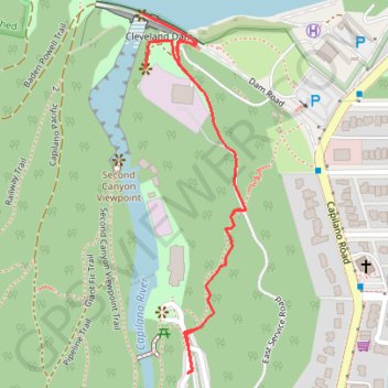
Capliano Canyon - Cleveland Dam
Interactive trail map
Trail profile
- Distance: 1.8 Km
- Elevation gain: 98 m
- Maximum elevation: 151 m
- Elevation loss: 98 m
- Minimum elevation: 81 m
About this trail
Name: Capliano Canyon - Cleveland Dam trail, distance, elevation, map, profile, GPS track
Coordinates: 49.35507 -123.11090 49.36030 -123.10858
Topography: Metro Vancouver Regional District topographic map, elevation, terrain
Other hiking, mountain biking, running and outdoor activity trails
Click on a trail to view its statistics, map and profile.