Lake Verna
Hike from Grand Lake to Lake Verna via East Inlet Trail, Adams Falls and Lone Pine Lake in the Rocky Mountain National Park. #Hiking #Mountain #Park #Forest #Nature #River #Lake #Falls
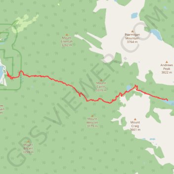
- Distance: 22.2 Km
- Elevation gain: 781 m
- Maximum elevation: 3,118 m
- Elevation loss: 786 m
- Minimum elevation: 2,560 m
- Moving time: 5 h 4 m
- Moving speed: 4.4 Km/h
- Maximum speed: 8.5 Km/h
- Total time: 5 h 44 m
- Global speed: 3.9 Km/h
Interactive trail map
Trail profile
- Distance: 22.2 Km
- Elevation gain: 781 m
- Maximum elevation: 3,118 m
- Elevation loss: 786 m
- Minimum elevation: 2,560 m
- Moving time: 5 h 4 m
- Moving speed: 4.4 Km/h
- Maximum speed: 8.5 Km/h
- Total time: 5 h 44 m
- Global speed: 3.9 Km/h
About this trail
Name: Lake Verna trail, distance, elevation, map, profile, GPS track
Start: East Inlet Trail, Grand Lake, Grand County, Colorado, United States (40.23889 -105.79933)
Coordinates: 40.22602 -105.80017 40.23983 -105.70990