Import a GPX file

Mount of Olives

#Hiking #Loop

  • Distance: 7.5 Km
  • Elevation gain: 343 m
  • Maximum elevation: 775 m
  • Elevation loss: 341 m
  • Minimum elevation: 592 m

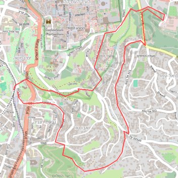
Interactive trail map

Trail profile

  • Distance: 7.5 Km
  • Elevation gain: 343 m
  • Maximum elevation: 775 m
  • Elevation loss: 341 m
  • Minimum elevation: 592 m

About this trail

Gear up for your next adventure:

🔥Camping Stove - Portable stoves to cook outdoors with ease
👟Sport Hiking Sandals - Breathable footwear for water crossings and camp rest
🧤Rechargeable Heated Gloves - Extreme warmth for Canadian winter expeditions
🔪Outdoor Multitool - Versatile tool for repairs and food prep in the wild
💡Portable Camping Lamp - Rechargeable lamp for campsite lighting

As an Amazon Associate, this site earns from qualifying purchases at no extra cost to you.