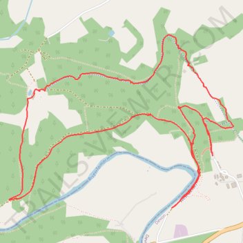
Walk around Tamar Trail Centre
- Distance: 7.3 Km
- Elevation gain: 153 m
- Maximum elevation: 109 m
- Elevation loss: 153 m
- Minimum elevation: 15 m
- Moving time: 1 h 50 m
- Moving speed: 3.9 Km/h
- Maximum speed: 11.2 Km/h
- Total time: 2 h 18 m
- Global speed: 3.1 Km/h
Interactive trail map
Trail profile
- Distance: 7.3 Km
- Elevation gain: 153 m
- Maximum elevation: 109 m
- Elevation loss: 153 m
- Minimum elevation: 15 m
- Moving time: 1 h 50 m
- Moving speed: 3.9 Km/h
- Maximum speed: 11.2 Km/h
- Total time: 2 h 18 m
- Global speed: 3.1 Km/h
About this trail
Name: Walk around Tamar Trail Centre trail, distance, elevation, map, profile, GPS track
Coordinates: 50.53110 -4.22523 50.54199 -4.20293