Mount Robson Provincial Park - Jasper
Interactive trail map
Trail profile
- Distance: 92.3 Km
- Elevation gain: 1,010 m
- Maximum elevation: 1,172 m
- Elevation loss: 780 m
- Minimum elevation: 824 m
About this trail
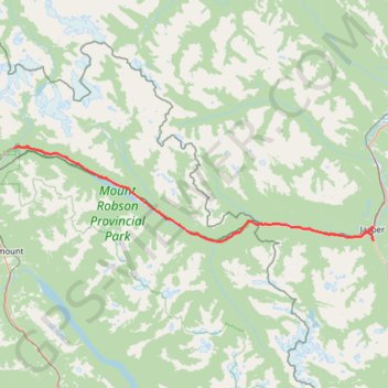
Name: Mount Robson Provincial Park - Jasper trail, distance, elevation, map, profile, GPS track
Coordinates: 52.84860 -119.23765 53.03428 -118.07631
Topography: Area H (Robson Valley/Canoe) topographic map, elevation, terrain
Other hiking, mountain biking, running and outdoor activity trails
Click on a trail to view its statistics, map and profile.