
Elephant's head to Bonneville shoreline down Mueller Park
- Distance: 6.3 Km
- Elevation gain: 154 m
- Maximum elevation: 1,911 m
- Elevation loss: 469 m
- Minimum elevation: 1,594 m
- Moving time: 1 h 27 m
- Moving speed: 4.3 Km/h
- Maximum speed: 6.8 Km/h
- Total time: 1 h 29 m
- Global speed: 4.2 Km/h
Interactive trail map
Trail profile
- Distance: 6.3 Km
- Elevation gain: 154 m
- Maximum elevation: 1,911 m
- Elevation loss: 469 m
- Minimum elevation: 1,594 m
- Moving time: 1 h 27 m
- Moving speed: 4.3 Km/h
- Maximum speed: 6.8 Km/h
- Total time: 1 h 29 m
- Global speed: 4.2 Km/h
About this trail
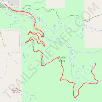
Name: Elephant's head to Bonneville shoreline down Mueller Park trail, distance, elevation, map, profile, GPS track
Start: Mueller Park Trail, Davis County, Utah, 84010, United States (40.85394 -111.81691)
End: 2010, Mueller Park Road, Bountiful, Davis County, Utah, 84010, United States (40.86450 -111.83781)
Coordinates: 40.84832 -111.83781 40.86450 -111.81645
Other hiking, mountain biking, running and outdoor activity trails
Click on a trail to view its statistics, map and profile.
