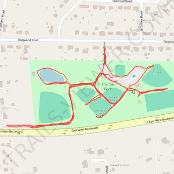
Elvaton Park
- Distance: 4.8 Km
- Elevation gain: 36 m
- Maximum elevation: 45 m
- Elevation loss: 36 m
- Minimum elevation: 30 m
- Moving time: 1 h 6 m
- Moving speed: 4.3 Km/h
- Maximum speed: 11.2 Km/h
- Total time: 1 h 6 m
- Global speed: 4.3 Km/h
Interactive trail map
Trail profile
- Distance: 4.8 Km
- Elevation gain: 36 m
- Maximum elevation: 45 m
- Elevation loss: 36 m
- Minimum elevation: 30 m
- Moving time: 1 h 6 m
- Moving speed: 4.3 Km/h
- Maximum speed: 11.2 Km/h
- Total time: 1 h 6 m
- Global speed: 4.3 Km/h
About this trail
Name: Elvaton Park trail, distance, elevation, map, profile, GPS track
Coordinates: 39.10633 -76.60170 39.10902 -76.59487