Import a GPX file

Pacifico Mountain trails

Click on a trail to view its statistics, map and profile.
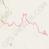
Pacifico Mountain

United States > California > Los Angeles County

Starting at Mill Creek Summit Picnic Area, a PCT access point on Angeles Forest Highway, the hike leaves the road and follows the Pacific Crest Trail into a dry high-country landscape of chaparral, manzanita, toyon, and open slopes. After climbing above the highway, the route bends around Tie Canyon, crosses…

Distance: 10.5 Km • Elevation gain: 931 m • Maximum elevation: 2,171 m

Gear up for your next adventure:

🥾Waterproof Hiking Boots - Essential footwear for rugged terrain and wet Canadian trails
💧Collapsible Water Bottle - Space-saving water bottle for outdoor activities
🚲Handlebar Phone Mount - View topographic-map.com live while cycling
🥾Light Hiking Boots - Lightweight and comfortable boots for day hikes
🧢Hiking Hat - Sun-protective and breathable hats for long treks

As an Amazon Associate, this site earns from qualifying purchases at no extra cost to you.