
Winter River Trail (Pink and Purple loop)
- Distance: 2.3 Km
- Elevation gain: 18 m
- Maximum elevation: 20 m
- Elevation loss: 16 m
- Minimum elevation: 8 m
- Moving time: 38 m 10 s
- Moving speed: 3.6 Km/h
- Maximum speed: 6.2 Km/h
- Total time: 42 m 20 s
- Global speed: 3.2 Km/h
Interactive trail map
Trail profile
- Distance: 2.3 Km
- Elevation gain: 18 m
- Maximum elevation: 20 m
- Elevation loss: 16 m
- Minimum elevation: 8 m
- Moving time: 38 m 10 s
- Moving speed: 3.6 Km/h
- Maximum speed: 6.2 Km/h
- Total time: 42 m 20 s
- Global speed: 3.2 Km/h
About this trail
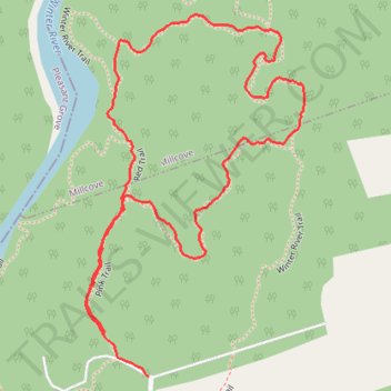
Name: Winter River Trail (Pink and Purple loop) trail, distance, elevation, map, profile, GPS track
Start: Pink Trail, Suffolk, Queens County, Prince Edward Island, C0A 1P0, Canada (46.35759 -63.06289)
Coordinates: 46.35692 -63.06325 46.36263 -63.05824
Topography: Queens County topographic map, elevation, terrain