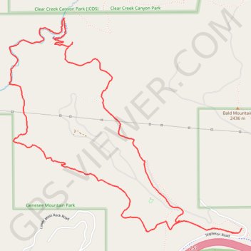
Import a GPX file

Beaver Brook Loop

Genesee Mountain Park. #Hiking #Snowshoeing #Loop #River #Mountain #Forest #Nature

  • Distance: 8.1 Km
  • Elevation gain: 337 m
  • Maximum elevation: 2,314 m
  • Elevation loss: 337 m
  • Minimum elevation: 2,013 m

Interactive trail map

Trail profile

  • Distance: 8.1 Km
  • Elevation gain: 337 m
  • Maximum elevation: 2,314 m
  • Elevation loss: 337 m
  • Minimum elevation: 2,013 m

About this trail

Name: Beaver Brook Loop trail, distance, elevation, map, profile, GPS track

Start: Beaver Brook Trail, Jefferson County, Colorado, United States (39.71531 -105.30904)

End: Beaver Brook Trail, Jefferson County, Colorado, United States (39.71531 -105.30904)

Coordinates: 39.71493 -105.33196 39.73126 -105.30904

Gear up for your next adventure:

🔥Camping Stove - Portable stoves to cook outdoors with ease
Bushcraft Tarp - Versatile emergency shelter or gear protection
🥾Lightweight Hiking Boots - Boots for comfort and mobility on long hikes
🧥Insulated Jacket - Keep warm in cold outdoor conditions
🥾Lightweight Hiking Shoes - Comfortable shoes for day hikes

As an Amazon Associate, this site earns from qualifying purchases at no extra cost to you.