Ten Falls Loop
Interactive trail map
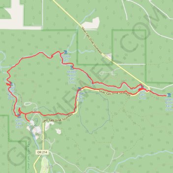
Trail profile
- Distance: 12.0 Km
- Elevation gain: 552 m
- Maximum elevation: 507 m
- Elevation loss: 553 m
- Minimum elevation: 322 m
About this trail
Name: Ten Falls Loop trail, distance, elevation, map, profile, GPS track
Start: Rim Trail, Marion County, Oregon, United States (44.87769 -122.65562)
End: Rim Trail, Marion County, Oregon, United States (44.87765 -122.65564)
Coordinates: 44.87765 -122.66247 44.89227 -122.61502
Other hiking, mountain biking, running and outdoor activity trails
Click on a trail to view its statistics, map and profile.
Trail of Ten Falls Loop via Canyon Trail and Rim Trail in Silver Falls State Park
United States > Oregon > Marion County
The Loop Trail of Ten Falls offers an iconic hiking experience with ten picturesque waterfalls along the way. Starting at South Falls, the tallest and one of the most iconic on the route, you'll pass behind its cascading waters before heading to Lower South Falls, another waterfall you can walk behind. The…
Distance: 12.0 Km • Elevation gain: 553 m • Maximum elevation: 506 m
Trail of Ten Falls in Silver Falls State Park
United States > Oregon > Marion County
The Trail of Ten Falls in Silver Falls State Park offers a spectacular journey through lush forested landscapes, where you'll encounter several dramatic waterfalls along the way. The trail provides opportunities to walk behind multiple falls, including the impressive South Falls, and lesser-known gems like…
Distance: 14.7 Km • Elevation gain: 703 m • Maximum elevation: 495 m
Silver Falls
United States > Oregon > Marion County
Round trip. #Hiking
Distance: 13.8 Km • Elevation gain: 613 m • Maximum elevation: 503 m