The Pinnacle
Interactive trail map
Trail profile
- Distance: 5.8 Km
- Elevation gain: 341 m
- Maximum elevation: 707 m
- Elevation loss: 341 m
- Minimum elevation: 400 m
About this trail
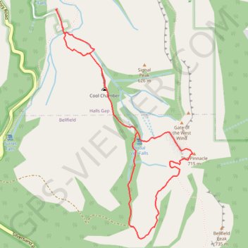
Name: The Pinnacle trail, distance, elevation, map, profile, GPS track
Coordinates: -37.16667 142.50237 -37.14917 142.51549
Other hiking, mountain biking, running and outdoor activity trails
Click on a trail to view its statistics, map and profile.
Halls Gap, The Pinnacle, Mount Rosea and Bellfield Lake loop
Australia > Victoria > Halls Gap
Distance: 30.4 Km • Elevation gain: 1,118 m • Maximum elevation: 988 m
Splitters Falls, Grand Canyon, Pinnacle, Sundial loop
Australia > Victoria > Halls Gap
Distance: 18.7 Km • Elevation gain: 706 m • Maximum elevation: 773 m