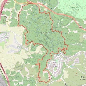
Ben-Shemen
Interactive trail map
Trail profile
- Distance: 20.9 Km
- Elevation gain: 509 m
- Maximum elevation: 202 m
- Elevation loss: 508 m
- Minimum elevation: 89 m
About this trail
Name: Ben-Shemen trail, distance, elevation, map, profile, GPS track
Start: Hevel Modiin Regional Council, Ramla Subdistrict, Center District, Israel (31.95060 34.95534)
Coordinates: 31.90811 34.94157 31.95215 34.97472
Other hiking, mountain biking, running and outdoor activity trails
Click on a trail to view its statistics, map and profile.
Ben Shemen Hertzel Blue Single
סינגל כחול משודרג ביער בן שמן
Distance: 10.9 Km • Elevation gain: 197 m • Maximum elevation: 176 m
מסלול חדש ומטורף. אהבתי.
Distance: 20.3 Km • Elevation gain: 284 m • Maximum elevation: 142 m