Indian Seats Loop Trail in Sawnee Mountain Preserve
The Indian Seats Loop Trail in Sawnee Mountain Preserve offers hikers a well-maintained path through diverse terrain, including wooded areas and rocky outcrops. The trail culminates at the Indian Seats—a series of natural rock formations resembling seats believed to have been used by Native Americans for ceremonial purposes—providing expansive views of the surrounding landscape. Along the route, hikers can observe remnants of historical gold mining activities, adding a touch of historical intrigue to the natural beauty. #Hiking #Mountain #Forest #Nature #Loop #Overlook
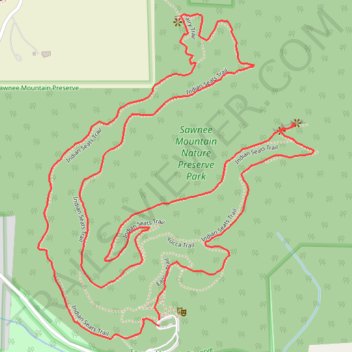
- Distance: 5.6 Km
- Elevation gain: 160 m
- Maximum elevation: 496 m
- Elevation loss: 162 m
- Minimum elevation: 389 m
- Moving time: 1 h 19 m
- Moving speed: 4.2 Km/h
- Maximum speed: 6.7 Km/h
- Total time: 1 h 25 m
- Global speed: 4.0 Km/h
Interactive trail map
Trail profile
- Distance: 5.6 Km
- Elevation gain: 160 m
- Maximum elevation: 496 m
- Elevation loss: 162 m
- Minimum elevation: 389 m
- Moving time: 1 h 19 m
- Moving speed: 4.2 Km/h
- Maximum speed: 6.7 Km/h
- Total time: 1 h 25 m
- Global speed: 4.0 Km/h
About this trail
Name: Indian Seats Loop Trail in Sawnee Mountain Preserve trail, distance, elevation, map, profile, GPS track
Start: Sawnee Mountain Preserve, Forsyth County, Georgia, 30028, United States (34.24496 -84.13901)
End: Sawnee Mountain Preserve, Forsyth County, Georgia, 30028, United States (34.24479 -84.13902)
Coordinates: 34.24444 -84.14302 34.25332 -84.13391
Other hiking, mountain biking, running and outdoor activity trails
Click on a trail to view its statistics, map and profile.
Indian Seats Loop Trail in Sawnee Mountain Nature Preserve Park
United States > Georgia > Forsyth County
The Indian Seats Loop Trail offers a remarkable hiking experience, combining natural beauty with a rich cultural history. As you ascend, you'll be rewarded with expansive views of the Blue Ridge Mountains, and on clear days, distant peaks like Yonah Mountain and Brasstown Bald become visible. At the summit,…
Distance: 5.6 Km • Elevation gain: 158 m • Maximum elevation: 496 m