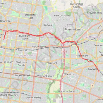
Box Hill - Bayswater
Interactive trail map
Trail profile
- Distance: 19.4 Km
- Elevation gain: 245 m
- Maximum elevation: 137 m
- Elevation loss: 217 m
- Minimum elevation: 54 m
About this trail
Name: Box Hill - Bayswater trail, distance, elevation, map, profile, GPS track
Coordinates: -37.84993 145.12098 -37.79680 145.27357
Other hiking, mountain biking, running and outdoor activity trails
Click on a trail to view its statistics, map and profile.