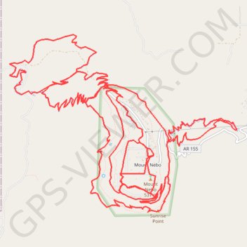
Mount Nebo State Park Trails
- Distance: 42.3 Km
- Elevation gain: 1,354 m
- Maximum elevation: 544 m
- Elevation loss: 1,355 m
- Minimum elevation: 206 m
- Moving time: 3 h 24 m
- Moving speed: 12.4 Km/h
- Maximum speed: 36.4 Km/h
- Total time: 3 h 45 m
- Global speed: 11.2 Km/h
Interactive trail map
Trail profile
- Distance: 42.3 Km
- Elevation gain: 1,354 m
- Maximum elevation: 544 m
- Elevation loss: 1,355 m
- Minimum elevation: 206 m
- Moving time: 3 h 24 m
- Moving speed: 12.4 Km/h
- Maximum speed: 36.4 Km/h
- Total time: 3 h 45 m
- Global speed: 11.2 Km/h
About this trail
Name: Mount Nebo State Park Trails trail, distance, elevation, map, profile, GPS track
Start: County Road 134, Mount Nebo, Yell County, Arkansas, United States (35.22028 -93.25130)
End: County Road 134, Mount Nebo, Yell County, Arkansas, United States (35.22043 -93.25118)
Coordinates: 35.21162 -93.27835 35.23891 -93.23547