Grandeur Peak from Church Fork
Interactive trail map
Trail profile
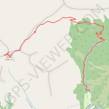
- Distance: 9.1 Km
- Elevation gain: 734 m
- Maximum elevation: 2,516 m
- Elevation loss: 733 m
- Minimum elevation: 1,801 m
About this trail
Name: Grandeur Peak from Church Fork trail, distance, elevation, map, profile, GPS track
Start: Church Fork, Grandeur Peak Trail, Salt Lake County, Utah, United States (40.70069 -111.74238)
End: Church Fork, Grandeur Peak Trail, Salt Lake County, Utah, United States (40.70071 -111.74235)
Coordinates: 40.70069 -111.76072 40.71286 -111.73900
Other hiking, mountain biking, running and outdoor activity trails
Click on a trail to view its statistics, map and profile.
Grandeur Peak Trail in Uinta-Wasatch-Cache National Forest
United States > Utah > Salt Lake County
The Grandeur Peak Trail offers hikers a scenic and relatively short but steep ascent through Utah's Wasatch Mountains. Starting at Church Fork, the trail follows a shaded creek before transitioning into a series of switchbacks, eventually leading to a ridge with panoramic views. Along the way, hikers can spot…
Distance: 9.3 Km • Elevation gain: 712 m • Maximum elevation: 2,515 m