Waterfall Canyon Trail in Uinta-Wasatch-Cache National Forest
The Waterfall Canyon Trail near Ogden, Utah, offers hikers a moderately challenging route through diverse terrain, including rocky paths and sections requiring light scrambling. Along the way, hikers can enjoy views of the surrounding mountains and the city of Ogden. The trail culminates at a striking waterfall cascading down a sheer cliff face, providing a rewarding endpoint for the hike. #Hiking #Canyon #Forest #Nature #Waterfall #Mountain
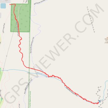
- Distance: 4.2 Km
- Elevation gain: 392 m
- Maximum elevation: 1,848 m
- Elevation loss: 392 m
- Minimum elevation: 1,456 m
- Moving time: 1 h 37 m
- Moving speed: 2.6 Km/h
- Maximum speed: 10.0 Km/h
- Total time: 2 h 4 m
- Global speed: 2.1 Km/h
Interactive trail map
Trail profile
- Distance: 4.2 Km
- Elevation gain: 392 m
- Maximum elevation: 1,848 m
- Elevation loss: 392 m
- Minimum elevation: 1,456 m
- Moving time: 1 h 37 m
- Moving speed: 2.6 Km/h
- Maximum speed: 10.0 Km/h
- Total time: 2 h 4 m
- Global speed: 2.1 Km/h
About this trail
Name: Waterfall Canyon Trail in Uinta-Wasatch-Cache National Forest trail, distance, elevation, map, profile, GPS track
Start: Taylor Canyon Trail, Ogden, Weber County, Utah, 84408, United States (41.21059 -111.93198)
End: Gib's Loop Trail, Ogden, Weber County, Utah, 84408, United States (41.21055 -111.93196)
Coordinates: 41.20027 -111.93198 41.21061 -111.91976