Bear Mountain Trail
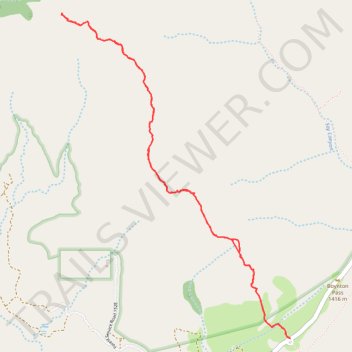
Interactive trail map
Trail profile
- Distance: 7.4 Km
- Elevation gain: 608 m
- Maximum elevation: 1,958 m
- Elevation loss: 607 m
- Minimum elevation: 1,398 m
- Moving time: 3 h 35 m
- Moving speed: 2.0 Km/h
- Maximum speed: 5.2 Km/h
- Total time: 4 h 33 m
- Global speed: 1.6 Km/h
About this trail
Name: Bear Mountain Trail trail, distance, elevation, map, profile, GPS track
Start: Forest Service Road 152C, Yavapai County, Arizona, 86340, United States (34.89366 -111.86517)
Coordinates: 34.89361 -111.88315 34.91467 -111.86513
Other hiking, mountain biking, running and outdoor activity trails
Click on a trail to view its statistics, map and profile.
Boynton Canyon Trail via Boynton Vista and Boynton Subway in Red Rock-Secret Mountain Wilderness
United States > Arizona > Yavapai County
The Boynton Canyon Trail offers a peaceful journey through shaded forests, towering red rock formations, and sweeping views of the canyon floor. While the trail itself is easy to follow, it features a bit of a climb toward the end, making it a nice mix of challenge and relaxation. For an extra treat, take the…
Distance: 12.8 Km • Elevation gain: 480 m • Maximum elevation: 1,595 m
Bear Mountain Trail in Red Rock-Secret Mountain Wilderness
United States > Arizona > Yavapai County
The Bear Mountain Trail offers a challenging and scenic hike, ideal for experienced hikers looking for stunning views and rugged terrain. As you ascend, you'll be treated to expansive vistas of the Sedona area, with sights of iconic landmarks like Fay Canyon, Wilson Mountain, and the Verde Valley. The…
Distance: 7.5 Km • Elevation gain: 643 m • Maximum elevation: 1,962 m
Bear Mountain Trail in Red Rock-Secret Mountain Wilderness
United States > Arizona > Yavapai County
The Bear Mountain Trail in Arizona's Red Rock-Secret Mountain Wilderness offers hikers a challenging ascent through rugged terrain, culminating in panoramic vistas of the surrounding red rock formations, deep canyons, and distant mountain ranges. Along the route, hikers can observe unique geological features…
Distance: 7.7 Km • Elevation gain: 630 m • Maximum elevation: 1,954 m