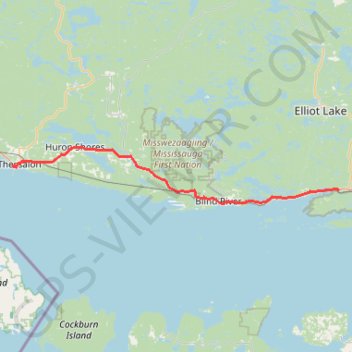
Thessalon - Spragge
Interactive trail map
Trail profile
- Distance: 83.8 Km
- Elevation gain: 384 m
- Maximum elevation: 236 m
- Elevation loss: 379 m
- Minimum elevation: 176 m
About this trail
Name: Thessalon - Spragge trail, distance, elevation, map, profile, GPS track
Coordinates: 46.18157 -83.56668 46.29710 -82.59987
Topography: Algoma District topographic map, elevation, terrain
Other hiking, mountain biking, running and outdoor activity trails
Click on a trail to view its statistics, map and profile.
Sault Ste. Marie - Thessalon
Canada > Ontario > Algoma District > Sault Ste. Marie
Lake Huron. #Bike #SaultSteMarie #Thessalon #Huron
Distance: 83.4 Km • Elevation gain: 309 m • Maximum elevation: 239 m