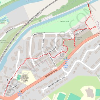
Holburne Park
Holburne, Park
- Distance: 1.0 Km
- Elevation gain: 39 m
- Maximum elevation: 66 m
- Elevation loss: 31 m
- Minimum elevation: 35 m
- Moving time: 19 m 6 s
- Moving speed: 3.2 Km/h
- Maximum speed: 9.9 Km/h
- Total time: 20 m 2 s
- Global speed: 3.1 Km/h
Interactive trail map
Trail profile
- Distance: 1.0 Km
- Elevation gain: 39 m
- Maximum elevation: 66 m
- Elevation loss: 31 m
- Minimum elevation: 35 m
- Moving time: 19 m 6 s
- Moving speed: 3.2 Km/h
- Maximum speed: 9.9 Km/h
- Total time: 20 m 2 s
- Global speed: 3.1 Km/h
About this trail
Name: Holburne Park trail, distance, elevation, map, profile, GPS track
Coordinates: 51.38746 -2.34728 51.39164 -2.34055