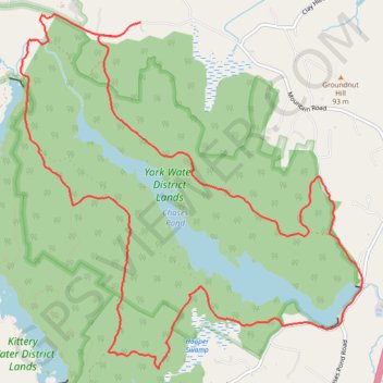
York Water District (YWD) loop
- Distance: 15.4 Km
- Elevation gain: 148 m
- Maximum elevation: 99 m
- Elevation loss: 156 m
- Minimum elevation: 48 m
Interactive trail map
Trail profile
- Distance: 15.4 Km
- Elevation gain: 148 m
- Maximum elevation: 99 m
- Elevation loss: 156 m
- Minimum elevation: 48 m
About this trail
Name: York Water District (YWD) loop trail, distance, elevation, map, profile, GPS track
Coordinates: 43.18439 -70.69096 43.21590 -70.64924