Import a GPX file

Birthing Cave

Coconino National Forest. #Hiking #Cave #Mountain #Forest #Nature

  • Distance: 3.1 Km
  • Elevation gain: 93 m
  • Maximum elevation: 1,473 m
  • Elevation loss: 93 m
  • Minimum elevation: 1,379 m

Interactive trail map

Trail profile

  • Distance: 3.1 Km
  • Elevation gain: 93 m
  • Maximum elevation: 1,473 m
  • Elevation loss: 93 m
  • Minimum elevation: 1,379 m

About this trail

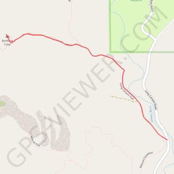
Name: Birthing Cave trail, distance, elevation, map, profile, GPS track

Start: Long Canyon Trail, Yavapai County, Arizona, United States (34.90666 -111.82415)

End: Long Canyon Trail, Yavapai County, Arizona, United States (34.90664 -111.82412)

Coordinates: 34.90664 -111.83622 34.91319 -111.82412

Gear up for your next adventure:

🔥Emergency Fire Starter - Reliable ignition source for all weather conditions
🔦LED Flashlight - Powerful and long-lasting flashlight for camping and emergencies
💧Hydration Pack - Hands-free hydration system for long hikes
🧭GPS Outdoor Watch - Smart watch for navigation and fitness tracking in nature
Lightweight Backpacking Tent - Compact tent for efficient hiking trips

As an Amazon Associate, this site earns from qualifying purchases at no extra cost to you.