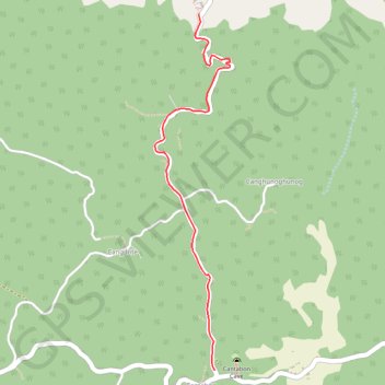
Cantabon Cave
- Distance: 4.0 Km
- Elevation gain: 324 m
- Maximum elevation: 446 m
- Elevation loss: 36 m
- Minimum elevation: 157 m
Interactive trail map
Trail profile
- Distance: 4.0 Km
- Elevation gain: 324 m
- Maximum elevation: 446 m
- Elevation loss: 36 m
- Minimum elevation: 157 m
About this trail
Name: Cantabon Cave trail, distance, elevation, map, profile, GPS track
Start: Pili, Banban, Siquijor, Negros Island Region, 6225, Philippines (9.21208 123.56135)
End: Cantabon, Siquijor, Negros Island Region, 6225, Philippines (9.18695 123.56245)
Coordinates: 9.18695 123.55815 9.21208 123.56358