Lough Curra
- Distance: 9.5 Km
- Elevation gain: 443 m
- Maximum elevation: 577 m
- Elevation loss: 445 m
- Minimum elevation: 136 m
Interactive trail map
Trail profile
- Distance: 9.5 Km
- Elevation gain: 443 m
- Maximum elevation: 577 m
- Elevation loss: 445 m
- Minimum elevation: 136 m
About this trail
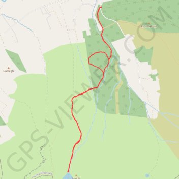
Name: Lough Curra trail, distance, elevation, map, profile, GPS track
Coordinates: 52.37025 -8.19537 52.40194 -8.18168
Other hiking, mountain biking, running and outdoor activity trails
Click on a trail to view its statistics, map and profile.
Thurles - Cork
Ireland > County Tipperary > Thurles
#Bike
Distance: 129.7 Km • Elevation gain: 1,137 m • Maximum elevation: 237 m