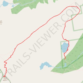
Little Echo Lake to James Peak Summit
- Distance: 11.4 Km
- Elevation gain: 701 m
- Maximum elevation: 4,039 m
- Elevation loss: 704 m
- Minimum elevation: 3,407 m
- Moving time: 4 h 29 m
- Moving speed: 2.5 Km/h
- Maximum speed: 5.5 Km/h
- Total time: 5 h 44 m
- Global speed: 2.0 Km/h
Interactive trail map
Trail profile
- Distance: 11.4 Km
- Elevation gain: 701 m
- Maximum elevation: 4,039 m
- Elevation loss: 704 m
- Minimum elevation: 3,407 m
- Moving time: 4 h 29 m
- Moving speed: 2.5 Km/h
- Maximum speed: 5.5 Km/h
- Total time: 5 h 44 m
- Global speed: 2.0 Km/h
About this trail
Name: Little Echo Lake to James Peak Summit trail, distance, elevation, map, profile, GPS track
Start: Ute Trail, Gilpin County, Colorado, United States (39.85660 -105.66954)
End: Ute Trail, Gilpin County, Colorado, United States (39.85646 -105.66962)
Coordinates: 39.85196 -105.69066 39.87042 -105.66442