Amherst Point Bird Sanctuary
Interactive trail map
Trail profile
- Distance: 4.6 Km
- Elevation gain: 46 m
- Maximum elevation: 30 m
- Elevation loss: 46 m
- Minimum elevation: 2 m
About this trail
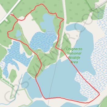
Name: Amherst Point Bird Sanctuary trail, distance, elevation, map, profile, GPS track
Coordinates: 45.78627 -64.26072 45.79842 -64.24460
Topography: Municipality of the County of Cumberland topographic map, elevation, terrain