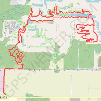
Balm Boyette MTB Loop
Interactive trail map
Trail profile
- Distance: 18.8 Km
- Elevation gain: 89 m
- Maximum elevation: 44 m
- Elevation loss: 87 m
- Minimum elevation: 25 m
About this trail
Name: Balm Boyette MTB Loop trail, distance, elevation, map, profile, GPS track
Start: Northwest, Hillsborough County, Florida, United States (27.77469 -82.21361)
End: Balm-Picnic Road, Hillsborough County, Florida, 33547, United States (27.76339 -82.21934)
Coordinates: 27.76339 -82.21999 27.78801 -82.19053