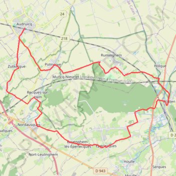
Les 3 Cayelles - Audruicq
- Distance: 36.8 Km
- Elevation gain: 193 m
- Maximum elevation: 56 m
- Elevation loss: 193 m
- Minimum elevation: 2 m
Interactive trail map
Trail profile
- Distance: 36.8 Km
- Elevation gain: 193 m
- Maximum elevation: 56 m
- Elevation loss: 193 m
- Minimum elevation: 2 m
About this trail
Name: Les 3 Cayelles - Audruicq trail, distance, elevation, map, profile, GPS track
Coordinates: 50.80465 2.05855 50.87600 2.21232