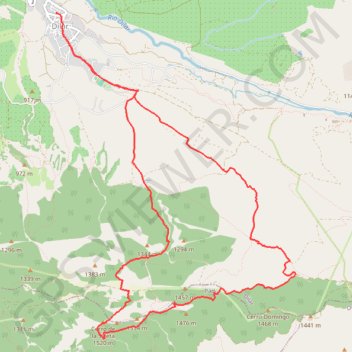
Silleta de Padul
- Distance: 15.1 Km
- Elevation gain: 711 m
- Maximum elevation: 1,499 m
- Elevation loss: 711 m
- Minimum elevation: 876 m
Interactive trail map
Trail profile
- Distance: 15.1 Km
- Elevation gain: 711 m
- Maximum elevation: 1,499 m
- Elevation loss: 711 m
- Minimum elevation: 876 m
About this trail
Name: Silleta de Padul trail, distance, elevation, map, profile, GPS track
Coordinates: 37.03759 -3.60155 37.07524 -3.56677
Other hiking, mountain biking, running and outdoor activity trails
Click on a trail to view its statistics, map and profile.
Southern section — European Divide Trail
France > Auvergne-Rhône-Alpes > Drôme > Valence
Distance: 2,423.8 Km • Elevation gain: 42,375 m • Maximum elevation: 2,005 m