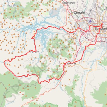
Bandung graventure
- Distance: 128.0 Km
- Elevation gain: 2,103 m
- Maximum elevation: 1,388 m
- Elevation loss: 2,098 m
- Minimum elevation: 638 m
Interactive trail map
Trail profile
- Distance: 128.0 Km
- Elevation gain: 2,103 m
- Maximum elevation: 1,388 m
- Elevation loss: 2,098 m
- Minimum elevation: 638 m
About this trail
Name: Bandung graventure trail, distance, elevation, map, profile, GPS track
Coordinates: -7.08968 107.31241 -6.90703 107.61483