
Airey Lake via Tuxachanie Trail in De Soto National Forest
Hiking to Airey Lake via the Tuxachanie Trail offers a peaceful journey through varied landscapes, from longleaf pine forests to bogs rich with wildflowers and pitcher plants. Along the way, you’ll traverse wetlands on boardwalks and cross creeks, finishing at the serene Airey Lake Recreation Area, perfect for a rest or picnic. The route blends diverse natural habitats, making it both a scenic and reflective hike. #Hiking #Lake #Forest #Nature
- Distance: 18.2 Km
- Elevation gain: 130 m
- Maximum elevation: 63 m
- Elevation loss: 130 m
- Minimum elevation: 33 m
- Moving time: 3 h 27 m
- Moving speed: 5.3 Km/h
- Maximum speed: 12.3 Km/h
- Total time: 3 h 30 m
- Global speed: 5.2 Km/h
Interactive trail map
Trail profile
- Distance: 18.2 Km
- Elevation gain: 130 m
- Maximum elevation: 63 m
- Elevation loss: 130 m
- Minimum elevation: 33 m
- Moving time: 3 h 27 m
- Moving speed: 5.3 Km/h
- Maximum speed: 12.3 Km/h
- Total time: 3 h 30 m
- Global speed: 5.2 Km/h
About this trail
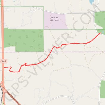
Name: Airey Lake via Tuxachanie Trail in De Soto National Forest trail, distance, elevation, map, profile, GPS track
Start: Tuxachanie Trail, Harrison County, Mississippi, United States (30.66699 -89.13315)
End: Tuxachanie Trail, Harrison County, Mississippi, United States (30.66686 -89.13336)
Coordinates: 30.66391 -89.13336 30.68928 -89.06115