Cawthra Mulock Nature Reserve Loop
- Distance: 2.8 Km
- Elevation gain: 50 m
- Maximum elevation: 249 m
- Elevation loss: 50 m
- Minimum elevation: 227 m
Interactive trail map
Trail profile
- Distance: 2.8 Km
- Elevation gain: 50 m
- Maximum elevation: 249 m
- Elevation loss: 50 m
- Minimum elevation: 227 m
About this trail
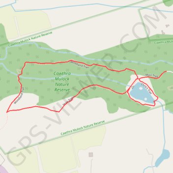
Name: Cawthra Mulock Nature Reserve Loop trail, distance, elevation, map, profile, GPS track
Coordinates: 44.06939 -79.52850 44.07203 -79.51720
Topography: King topographic map, elevation, terrain
Other hiking, mountain biking, running and outdoor activity trails
Click on a trail to view its statistics, map and profile.