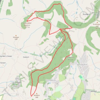
Standish Wood Loop Hike
- Distance: 11.1 Km
- Elevation gain: 253 m
- Maximum elevation: 253 m
- Elevation loss: 252 m
- Minimum elevation: 156 m
- Moving time: 2 h 23 m
- Moving speed: 4.7 Km/h
- Maximum speed: 9.0 Km/h
- Total time: 2 h 44 m
- Global speed: 4.1 Km/h
Interactive trail map
Trail profile
- Distance: 11.1 Km
- Elevation gain: 253 m
- Maximum elevation: 253 m
- Elevation loss: 252 m
- Minimum elevation: 156 m
- Moving time: 2 h 23 m
- Moving speed: 4.7 Km/h
- Maximum speed: 9.0 Km/h
- Total time: 2 h 44 m
- Global speed: 4.1 Km/h
About this trail
Name: Standish Wood Loop Hike trail, distance, elevation, map, profile, GPS track
Coordinates: 51.75477 -2.26175 51.78372 -2.23855
Other hiking, mountain biking, running and outdoor activity trails
Click on a trail to view its statistics, map and profile.
Five Valleys Loop Walk
United Kingdom > England > Gloucestershire > Stroud > Randwick
Distance: 34.2 Km • Elevation gain: 907 m • Maximum elevation: 253 m
Stroud-Haresfield
United Kingdom > England > Gloucestershire > Stonehouse
Distance: 26.4 Km • Elevation gain: 430 m • Maximum elevation: 246 m
Dean2023-311
United Kingdom > England > Oxfordshire > Oxford
Distance: 310.3 Km • Elevation gain: 3,366 m • Maximum elevation: 290 m
Stroud North loop
United Kingdom > England > Gloucestershire > Stroud > Selsley
Distance: 14.5 Km • Elevation gain: 349 m • Maximum elevation: 223 m
Five Valleys
United Kingdom > England > Gloucestershire > Stonehouse > Leonard Stanley
Distance: 38.1 Km • Elevation gain: 882 m • Maximum elevation: 253 m