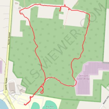
Denison Preserve Trail
- Distance: 3.3 Km
- Elevation gain: 82 m
- Maximum elevation: 337 m
- Elevation loss: 83 m
- Minimum elevation: 294 m
- Moving time: 58 m 42 s
- Moving speed: 3.4 Km/h
- Maximum speed: 11.3 Km/h
- Total time: 1 h 7 m
- Global speed: 2.9 Km/h
Interactive trail map
Trail profile
- Distance: 3.3 Km
- Elevation gain: 82 m
- Maximum elevation: 337 m
- Elevation loss: 83 m
- Minimum elevation: 294 m
- Moving time: 58 m 42 s
- Moving speed: 3.4 Km/h
- Maximum speed: 11.3 Km/h
- Total time: 1 h 7 m
- Global speed: 2.9 Km/h
About this trail
Name: Denison Preserve Trail trail, distance, elevation, map, profile, GPS track
Coordinates: 40.07666 -82.52007 40.08432 -82.51310