Thank you for supporting this site ❤️
Make a donation
Make a donation
Gear up for your next adventure:
As an Amazon Associate, this site earns from qualifying purchases at no extra cost to you.
Afternoon Run
- Distance: 6.9 Km
- Elevation gain: 56 m
- Maximum elevation: 441 m
- Elevation loss: 55 m
- Minimum elevation: 404 m
- Moving time: 33 m 5 s
- Moving speed: 12.6 Km/h
- Maximum speed: 19.9 Km/h
- Total time: 41 m 13 s
- Global speed: 10.1 Km/h
Interactive trail map
Thank you for supporting this site ❤️
Make a donation
Make a donation
Gear up for your next adventure:
As an Amazon Associate, this site earns from qualifying purchases at no extra cost to you.
Trail profile
- Distance: 6.9 Km
- Elevation gain: 56 m
- Maximum elevation: 441 m
- Elevation loss: 55 m
- Minimum elevation: 404 m
- Moving time: 33 m 5 s
- Moving speed: 12.6 Km/h
- Maximum speed: 19.9 Km/h
- Total time: 41 m 13 s
- Global speed: 10.1 Km/h
Thank you for supporting this site ❤️
Make a donation
Make a donation
Gear up for your next adventure:
As an Amazon Associate, this site earns from qualifying purchases at no extra cost to you.
About this trail
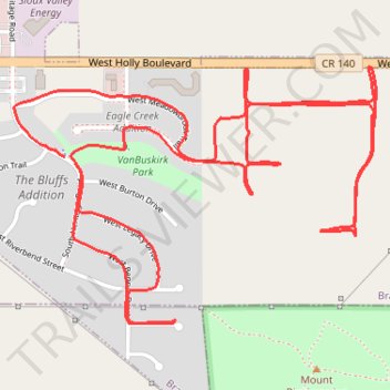
Name: Afternoon Run trail, distance, elevation, map, profile, GPS track
Coordinates: 43.58680 -96.61962 43.59453 -96.60464
Thank you for supporting this site ❤️
Make a donation
Make a donation
Gear up for your next adventure:
As an Amazon Associate, this site earns from qualifying purchases at no extra cost to you.