Pinson Mounds Loop Walk
- Distance: 6.9 Km
- Elevation gain: 57 m
- Maximum elevation: 140 m
- Elevation loss: 57 m
- Minimum elevation: 115 m
- Moving time: 1 h 52 m
- Moving speed: 3.7 Km/h
- Maximum speed: 5.3 Km/h
- Total time: 2 h 53 s
- Global speed: 3.4 Km/h
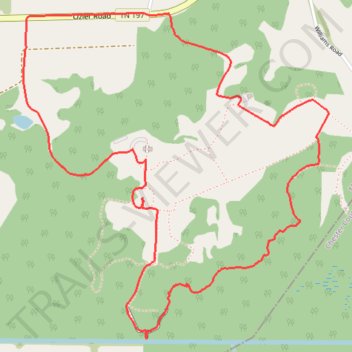
Interactive trail map
Trail profile
- Distance: 6.9 Km
- Elevation gain: 57 m
- Maximum elevation: 140 m
- Elevation loss: 57 m
- Minimum elevation: 115 m
- Moving time: 1 h 52 m
- Moving speed: 3.7 Km/h
- Maximum speed: 5.3 Km/h
- Total time: 2 h 53 s
- Global speed: 3.4 Km/h
About this trail
Name: Pinson Mounds Loop Walk trail, distance, elevation, map, profile, GPS track
Start: Pinson Mound Road, Madison County, West Tennessee, Tennessee, United States (35.50011 -88.67678)
End: Pinson Mound Road, Madison County, West Tennessee, Tennessee, United States (35.50019 -88.67678)
Coordinates: 35.48887 -88.68940 35.50423 -88.67173
Other hiking, mountain biking, running and outdoor activity trails
Click on a trail to view its statistics, map and profile.
Gmaps Pedometer Route
United States > Kentucky > Fulton County > Hickman
Distance: 502.9 Km • Elevation gain: 4,204 m • Maximum elevation: 592 m