Wind Cave Trail in Tonto National Forest
The Wind Cave Trail in Arizona's Tonto National Forest offers hikers a rewarding journey through Sonoran Desert landscape. Along the path, you'll encounter rugged terrain, including steep ascents and rocky sections, leading to the distinctive Wind Cave—a natural alcove carved into the mountainside. From the trail's summit, panoramic views of the surrounding desert vistas, mountain ranges, and the distant cityscape of Phoenix unfold, providing a memorable hiking experience. #Hiking #Mountain #Desert #Nature #Overlook
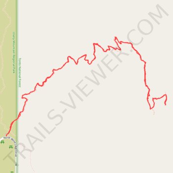
- Distance: 5.4 Km
- Elevation gain: 346 m
- Maximum elevation: 931 m
- Elevation loss: 344 m
- Minimum elevation: 617 m
- Moving time: 1 h 34 m
- Moving speed: 3.4 Km/h
- Maximum speed: 6.6 Km/h
- Total time: 1 h 48 m
- Global speed: 3.0 Km/h
Interactive trail map
Trail profile
- Distance: 5.4 Km
- Elevation gain: 346 m
- Maximum elevation: 931 m
- Elevation loss: 344 m
- Minimum elevation: 617 m
- Moving time: 1 h 34 m
- Moving speed: 3.4 Km/h
- Maximum speed: 6.6 Km/h
- Total time: 1 h 48 m
- Global speed: 3.0 Km/h
About this trail
Name: Wind Cave Trail in Tonto National Forest trail, distance, elevation, map, profile, GPS track
Start: North Wind Cave Drive, Maricopa County, Arizona, 85207, United States (33.47401 -111.60738)
End: Wind Cave Trail, Maricopa County, Arizona, 85207, United States (33.47413 -111.60725)
Coordinates: 33.47401 -111.60738 33.48009 -111.59563
Other hiking, mountain biking, running and outdoor activity trails
Click on a trail to view its statistics, map and profile.