Make a donation
Gear up for your next adventure:
As an Amazon Associate, this site earns from qualifying purchases at no extra cost to you.
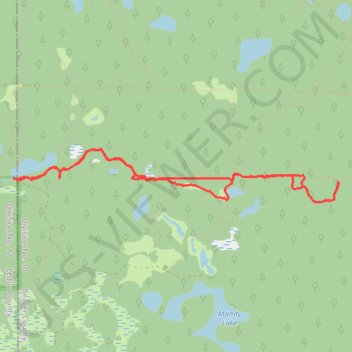
Air Cache Northeast of Mandy Lake
- Distance: 6.3 Km
- Elevation gain: 32 m
- Maximum elevation: 778 m
- Elevation loss: 32 m
- Minimum elevation: 769 m
- Moving time: 2 h 3 m
- Moving speed: 3.1 Km/h
- Maximum speed: 5.2 Km/h
- Total time: 3 h 26 m
- Global speed: 1.8 Km/h
Interactive trail map
Make a donation
Gear up for your next adventure:
As an Amazon Associate, this site earns from qualifying purchases at no extra cost to you.
Trail profile
- Distance: 6.3 Km
- Elevation gain: 32 m
- Maximum elevation: 778 m
- Elevation loss: 32 m
- Minimum elevation: 769 m
- Moving time: 2 h 3 m
- Moving speed: 3.1 Km/h
- Maximum speed: 5.2 Km/h
- Total time: 3 h 26 m
- Global speed: 1.8 Km/h
Make a donation
Gear up for your next adventure:
As an Amazon Associate, this site earns from qualifying purchases at no extra cost to you.
About this trail
Name: Air Cache Northeast of Mandy Lake trail, distance, elevation, map, profile, GPS track
Start: Township Road 502, Leduc County, Alberta, Canada (53.30879 -113.00161)
End: Township Road 502, Leduc County, Alberta, Canada (53.30883 -113.00112)
Coordinates: 53.30721 -113.00161 53.31079 -112.96504
Topography: Leduc County topographic map, elevation, terrain
Make a donation
Gear up for your next adventure:
As an Amazon Associate, this site earns from qualifying purchases at no extra cost to you.
Other hiking, mountain biking, running and outdoor activity trails
Click on a trail to view its statistics, map and profile.
Ministik Lake Game Bird Sanctuary
Canada > Alberta > Leduc County
Distance: 7.6 Km • Elevation gain: 50 m • Maximum elevation: 778 m