Eagle Creek Park Loop via Red Trail
The Eagle Creek Park Loop via Red Trail offers a delightful escape into nature, characterized by scenic views of the Eagle Creek Reservoir and lush wooded areas. Hikers can enjoy encounters with local wildlife, including various bird species, amidst diverse plant life that enhances the trail's natural beauty. With its well-maintained paths and tranquil surroundings, this trail provides a perfect blend of exercise and relaxation for outdoor enthusiasts of all skill levels. #Hiking #Loop #Lake #Forest #Nature
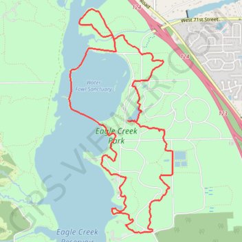
- Distance: 11.3 Km
- Elevation gain: 82 m
- Maximum elevation: 264 m
- Elevation loss: 82 m
- Minimum elevation: 238 m
- Moving time: 2 h 20 m
- Moving speed: 4.8 Km/h
- Maximum speed: 6.6 Km/h
- Total time: 2 h 23 m
- Global speed: 4.7 Km/h
Interactive trail map
Trail profile
- Distance: 11.3 Km
- Elevation gain: 82 m
- Maximum elevation: 264 m
- Elevation loss: 82 m
- Minimum elevation: 238 m
- Moving time: 2 h 20 m
- Moving speed: 4.8 Km/h
- Maximum speed: 6.6 Km/h
- Total time: 2 h 23 m
- Global speed: 4.7 Km/h
About this trail
Name: Eagle Creek Park Loop via Red Trail trail, distance, elevation, map, profile, GPS track
Start: Red Trail, Indianapolis, Marion County, Indiana, 46253, United States (39.85582 -86.29328)
End: Red Trail, Indianapolis, Marion County, Indiana, 46253, United States (39.85569 -86.29326)
Coordinates: 39.85541 -86.30646 39.88248 -86.29014
Other hiking, mountain biking, running and outdoor activity trails
Click on a trail to view its statistics, map and profile.
Indianapolis - Eagle Creek Park
United States > Indiana > Marion County > Indianapolis > Legendary Hills
Morning E-Bike Ride
Distance: 64.0 Km • Elevation gain: 185 m • Maximum elevation: 265 m