Heathcote MTB Loop
Interactive trail map
Trail profile
- Distance: 10.5 Km
- Elevation gain: 153 m
- Maximum elevation: 141 m
- Elevation loss: 153 m
- Minimum elevation: 90 m
About this trail
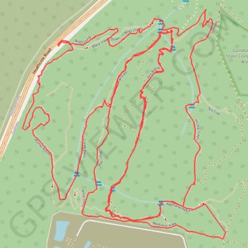
Name: Heathcote MTB Loop trail, distance, elevation, map, profile, GPS track
Coordinates: -34.03752 150.96239 -34.02746 150.97310
Other hiking, mountain biking, running and outdoor activity trails
Click on a trail to view its statistics, map and profile.