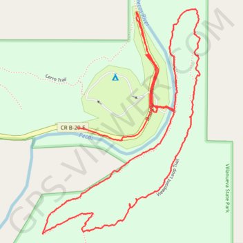
Hike in Villanueva State Park
- Distance: 4.7 Km
- Elevation gain: 146 m
- Maximum elevation: 1,864 m
- Elevation loss: 147 m
- Minimum elevation: 1,751 m
- Moving time: 1 h 56 m
- Moving speed: 2.4 Km/h
- Maximum speed: 18.3 Km/h
- Total time: 5 h 1 m
- Global speed: 0.9 Km/h
Interactive trail map
Trail profile
- Distance: 4.7 Km
- Elevation gain: 146 m
- Maximum elevation: 1,864 m
- Elevation loss: 147 m
- Minimum elevation: 1,751 m
- Moving time: 1 h 56 m
- Moving speed: 2.4 Km/h
- Maximum speed: 18.3 Km/h
- Total time: 5 h 1 m
- Global speed: 0.9 Km/h
About this trail
Name: Hike in Villanueva State Park trail, distance, elevation, map, profile, GPS track
Coordinates: 35.26035 -105.33903 35.26824 -105.33227