Make a donation
Gear up for your next adventure:
As an Amazon Associate, this site earns from qualifying purchases at no extra cost to you.
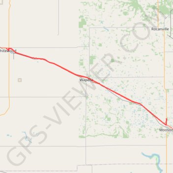
Whitewood - Moosomin
Interactive trail map
Make a donation
Gear up for your next adventure:
As an Amazon Associate, this site earns from qualifying purchases at no extra cost to you.
Trail profile
- Distance: 50.0 Km
- Elevation gain: 38 m
- Maximum elevation: 602 m
- Elevation loss: 68 m
- Minimum elevation: 569 m
Make a donation
Gear up for your next adventure:
As an Amazon Associate, this site earns from qualifying purchases at no extra cost to you.
About this trail
Name: Whitewood - Moosomin trail, distance, elevation, map, profile, GPS track
Start: Lalonde Street, Whitewood, Saskatchewan, S0G 5C0, Canada (50.33487 -102.26686)
End: Highway 8, Moosomin, Moosomin No. 121, Saskatchewan, S0G 3N0, Canada (50.17088 -101.67573)
Coordinates: 50.15611 -102.26686 50.33682 -101.67573
Topography: Saskatchewan topographic map, elevation, terrain
Make a donation
Gear up for your next adventure:
As an Amazon Associate, this site earns from qualifying purchases at no extra cost to you.
Other hiking, mountain biking, running and outdoor activity trails
Click on a trail to view its statistics, map and profile.