Lower Calf Creek Falls Trail in Grand Staircase-Escalante National Monument
The Lower Calf Creek Falls Trail offers a captivating desert hike, leading you through a landscape of red sandstone walls and shaded creekside areas. Along the route, you'll encounter unique features such as ancient rock art and Fremont culture granaries, adding an intriguing historical dimension to the natural beauty. The trail culminates at the impressive Lower Calf Creek Falls, where a peaceful sandy area allows for rest, and the chance to dip in the cold pool beneath the falls. #Hiking #Canyon #Rock #Waterfall #River #Nature
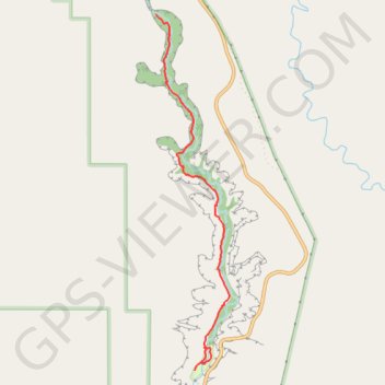
- Distance: 10.5 Km
- Elevation gain: 470 m
- Maximum elevation: 1,736 m
- Elevation loss: 470 m
- Minimum elevation: 1,630 m
Interactive trail map
Trail profile
- Distance: 10.5 Km
- Elevation gain: 470 m
- Maximum elevation: 1,736 m
- Elevation loss: 470 m
- Minimum elevation: 1,630 m
About this trail
Name: Lower Calf Creek Falls Trail in Grand Staircase-Escalante National Monument trail, distance, elevation, map, profile, GPS track
Start: UT 12, Boulder, Garfield County, Utah, United States (37.79368 -111.41500)
End: UT 12, Boulder, Garfield County, Utah, United States (37.79366 -111.41501)
Coordinates: 37.79366 -111.41994 37.82897 -111.41066
Other hiking, mountain biking, running and outdoor activity trails
Click on a trail to view its statistics, map and profile.
Lower Calf Creek Falls Trail in Grand Staircase-Escalante National Monument
United States > Utah > Garfield County
The Lower Calf Creek Falls Trail in Grand Staircase-Escalante National Monument offers hikers a journey through high-walled canyons, verdant creekside vegetation, and historical artifacts. Along the path, one can observe ancient Fremont granaries and pictographs, as well as beaver dams and desert varnish on…
Distance: 9.5 Km • Elevation gain: 443 m • Maximum elevation: 1,737 m