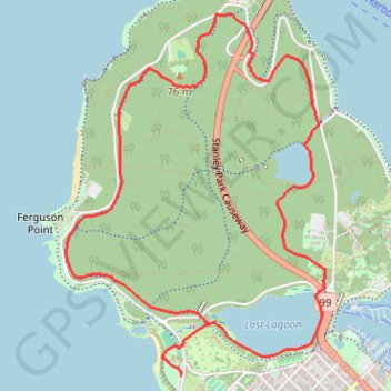
Stanley Park Loop
Interactive trail map
Trail profile
- Distance: 8.0 Km
- Elevation gain: 144 m
- Maximum elevation: 82 m
- Elevation loss: 144 m
- Minimum elevation: -5 m
About this trail
Name: Stanley Park Loop trail, distance, elevation, map, profile, GPS track
Coordinates: 49.29280 -123.15751 49.31195 -123.13644
Topography: Vancouver topographic map, elevation, terrain
Other hiking, mountain biking, running and outdoor activity trails
Click on a trail to view its statistics, map and profile.