Magnolia Gravel Galore
- Distance: 92.4 Km
- Elevation gain: 1,476 m
- Maximum elevation: 379 m
- Elevation loss: 1,475 m
- Minimum elevation: 277 m
- Moving time: 3 h 43 m
- Moving speed: 24.8 Km/h
- Maximum speed: 62.2 Km/h
- Total time: 3 h 44 m
- Global speed: 24.7 Km/h
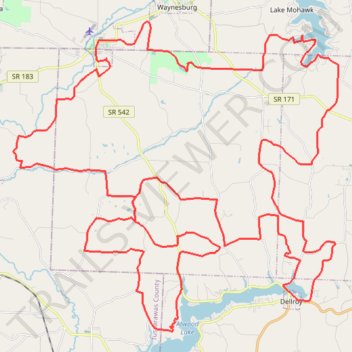
Interactive trail map
Trail profile
- Distance: 92.4 Km
- Elevation gain: 1,476 m
- Maximum elevation: 379 m
- Elevation loss: 1,475 m
- Minimum elevation: 277 m
- Moving time: 3 h 43 m
- Moving speed: 24.8 Km/h
- Maximum speed: 62.2 Km/h
- Total time: 3 h 44 m
- Global speed: 24.7 Km/h
About this trail
Name: Magnolia Gravel Galore trail, distance, elevation, map, profile, GPS track
Start: Morges Road, Magnolia, Carroll County, Ohio, 44643, United States (40.64774 -81.29324)
End: Morges Road, Magnolia, Carroll County, Ohio, 44643, United States (40.64757 -81.29324)
Coordinates: 40.54265 -81.34058 40.66253 -81.17553