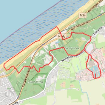
Centerparc 7k
name=centerparc 7k
- Distance: 7.0 Km
- Elevation gain: 37 m
- Maximum elevation: 12 m
- Elevation loss: 37 m
- Minimum elevation: -1 m
Interactive trail map
Trail profile
- Distance: 7.0 Km
- Elevation gain: 37 m
- Maximum elevation: 12 m
- Elevation loss: 37 m
- Minimum elevation: -1 m
About this trail
Name: Centerparc 7k trail, distance, elevation, map, profile, GPS track
Coordinates: 51.27978 3.03825 51.28923 3.06658
Other hiking, mountain biking, running and outdoor activity trails
Click on a trail to view its statistics, map and profile.
T3_Blankenb-Oostend
Belgium > West Flanders > Brugge > Blankenberge
<p>Uit wandelgids 'Treinstapper 3'</p> <p><strong>GR 5A Kustroute</strong></p> <p>Een dagje 'uitwaaien aan zee'. Je wandelt een groot deel op de GR 5A en geniet van een voortdurende afwisseling: zee, strand, duinen, duinpaden en -bossen. Ontdek de 'aubette de la douane' of wat Einstein naar De Haan dreef. Op…
Distance: 23.6 Km • Elevation gain: 167 m • Maximum elevation: 16 m
De Haan - Duinbossen
Belgium > West Flanders > Ostend > Vlissegem
Distance: 6.6 Km • Elevation gain: 31 m • Maximum elevation: 12 m
Toerke_de_haan_5k
Belgium > West Flanders > Ostend > De Haan > Klemskerke
name=toerke_de_haan_5k
Distance: 5.1 Km • Elevation gain: 31 m • Maximum elevation: 12 m
Duinbossen_dehaan
Belgium > West Flanders > Ostend > De Haan > Klemskerke
Distance: 11.2 Km • Elevation gain: 62 m • Maximum elevation: 12 m