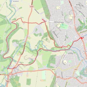
Canal walk public foot paths - Wordsley
- Distance: 13.0 Km
- Elevation gain: 120 m
- Maximum elevation: 115 m
- Elevation loss: 120 m
- Minimum elevation: 54 m
- Moving time: 2 h 55 m
- Moving speed: 4.4 Km/h
- Maximum speed: 11.1 Km/h
- Total time: 3 h 49 m
- Global speed: 3.4 Km/h
Interactive trail map
Trail profile
- Distance: 13.0 Km
- Elevation gain: 120 m
- Maximum elevation: 115 m
- Elevation loss: 120 m
- Minimum elevation: 54 m
- Moving time: 2 h 55 m
- Moving speed: 4.4 Km/h
- Maximum speed: 11.1 Km/h
- Total time: 3 h 49 m
- Global speed: 3.4 Km/h
About this trail
Name: Canal walk public foot paths - Wordsley trail, distance, elevation, map, profile, GPS track
Coordinates: 52.46371 -2.20842 52.48397 -2.15577