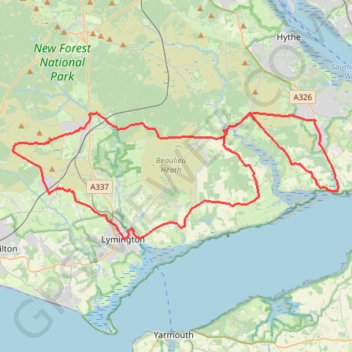
Downhill to Brock – Beaulieu Heath Road Loop from Sway
- Distance: 62.6 Km
- Elevation gain: 378 m
- Maximum elevation: 62 m
- Elevation loss: 378 m
- Minimum elevation: -1 m
- Moving time: 2 h 47 m
- Moving speed: 22.5 Km/h
- Maximum speed: 54.6 Km/h
- Total time: 2 h 47 m
- Global speed: 22.5 Km/h
Interactive trail map
Trail profile
- Distance: 62.6 Km
- Elevation gain: 378 m
- Maximum elevation: 62 m
- Elevation loss: 378 m
- Minimum elevation: -1 m
- Moving time: 2 h 47 m
- Moving speed: 22.5 Km/h
- Maximum speed: 54.6 Km/h
- Total time: 2 h 47 m
- Global speed: 22.5 Km/h
About this trail
Name: Downhill to Brock – Beaulieu Heath Road Loop from Sway trail, distance, elevation, map, profile, GPS track
Coordinates: 50.75829 -1.63837 50.82800 -1.35473